
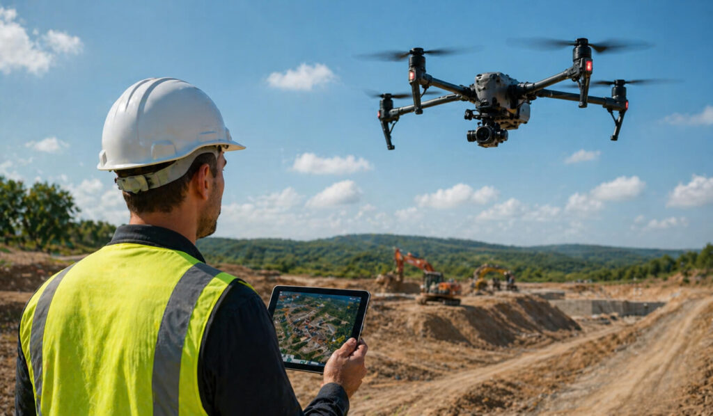
Have you ever wished you could gain a complete, unobstructed bird’s-eye view of your most complex projects? In the past, managing vast job sites, sprawling farmlands, or expansive real estate required tedious, time-consuming, and often dangerous groundwork. Welcome to the modern era, where drone surveying and mapping has completely revolutionized how we gather spatial data and manage large-scale operations.
Whether you are trying to keep a massive commercial build on schedule or monitoring the health of a remote forest, having accurate, high-fidelity data is no longer a luxury—it is a necessity. Let’s dive into what make
The Transformative Power of Drone Surveying and Mapping
Drones are no longer just tools for capturing beautiful cinematic videos. Today, professional drone surveying and mapping is a highly technical, data-driven service that captures millions of data points from the sky. By using advanced photogrammetry and sensors, drones can create highly accurate, measurable representations of the physical world. This allows project owners, engineers, and surveyors to make faster, more informed decisions based on a foundation of absolute digital truth.
Top Industry Use Cases for Drone Aerial Surveying
The applications for this technology are vast. Here is how different sectors are utilizing aerial data to work smarter and safer.
Elevating the Construction Industry
The construction industry benefits greatly from drone mapping. When you are managing a busy job site, having eyes in the sky changes everything. At Orange Grove Partners, we understand this firsthand. We provide up-to-date aerial documentation of your project on demand. By utilizing drone surveying and mapping, we allow your team to track progress, plan complex logistics, or memorialize underground utility locations with absolute precision.
Our drone aerial surveying capabilities ensure that you have a comprehensive view of the entire site, providing critical data that traditional ground methods might miss. Whether you need a high-altitude aerial survey for initial site planning or detailed drone surveying and mapping for volume calculations—such as analyzing stockpiles of raw materials like dirt and gravel—our team delivers high-resolution results. Furthermore, frequent aerial survey passes help keep off-site stakeholders informed and projects on schedule, providing a visual record that is invaluable for large-scale coordination.
Land Surveying and Real Estate Evaluation
Land surveyors are an obvious beneficiary of aerial mapping. Their primary job is to take precise measurements on pieces of land in order to determine accurate boundaries. The data they collect directly assists in the creation of maps, plots, and legal documentation.
For developers and investors considering buying large areas of real estate, an up-to-date aerial survey can be of considerable value in determining if the property is right for them before committing capital. Beyond flat boundaries, the integration of 3d photography real estate allows potential buyers to virtually explore land and finished properties. This high-end 3d photography real estate brings flat maps to life with incredible depth, detail, and spatial context, serving as a powerful tool for marketing and feasibility studies.
Agriculture, Forestry, and Environmental Conservation
The impact of drone mapping stretches far beyond concrete and steel. In agriculture, aerial maps give farmers the power to quickly analyze the health of their crops, providing crucial data to guide watering, fertilizing, and harvesting decisions.
Similarly, environmental conservation significantly benefits from drone mapping, offering a new perspective on monitoring and preserving natural habitats. Drones provide an efficient and much less intrusive means of collecting data across vast and inaccessible areas. This aids heavily in efforts like monitoring wildlife populations and assessing the impact of natural disasters on fragile ecosystems. In forestry, detailed maps allow teams to ensure the health of the forest is monitored, tree counts can be determined accurately, and illegal logging can be detected and tracked.
Emergency Management and Industrial Inspections
When disaster strikes, quick and accurate information is vital for emergency management to respond effectively—especially when the devastation covers a large geographical area. Using drone photogrammetry, officials can determine the most damaged areas of a disaster (think flood or hurricane) safely and rapidly. On a larger industrial scale, drone aerial surveying can do things like inspect massive solar farms, easily spotting problem spots in the solar panels with the aid of infrared imagery without putting human inspectors at risk.
Key Benefits of Choosing Professional Aerial Documentation
Why should you integrate this technology into your standard workflow? The advantages are clear and measurable:
- Unmatched Precision: Capture millimetric data and volume calculations that traditional ground crews simply cannot achieve in a single day.
- Enhanced Safety: Keep your personnel out of harm’s way by flying drones over hazardous terrain, active disaster zones, or busy construction sites.
- Time and Cost Efficiency: Dramatically reduce the man-hours required for site surveying, translating to massive savings on your project’s bottom line.
- Comprehensive Visualization: Utilize advanced deliverables like 3d photography real estate to give stakeholders and clients an interactive, highly detailed view of the project’s progress or potential.
Contact Our Construction Technology & Reality Capture Team
At Orange Grove Partners (OGP), helping modern engineering and construction companies integrate cutting-edge technology into their field workflows is our top priority.
As a trusted, specialized construction technology firm with over 100 years of combined network experience, our experts specialize in deploying high-definition 3D laser scanning, drone aerial mapping, 3D modeling & BIM services, VDC execution planning, constructability reviews, and specialized project management supplemental staffing. We bridge the gap between physical job sites and digital workflows—ensuring millimeter-accurate reality capture, zeroed-out field clashes, and seamless technology adoption for field crews.
We proudly serve general contractors, MEP engineers, design-builders, and commercial project owners across key regional hubs, including Florida (Miami, Fort Lauderdale, West Palm Beach, Tampa, Orlando) and Tennessee (Nashville, Memphis, Knoxville). Whether you need pre-construction reality capture, on-site tech implementation, or fractional VDC management, give us a call today at (561) 225-4220 or get in touch online for expert construction tech solutions you can rely on.
Hire Our Services In
- Florida: Miami-Dade, Broward, Palm Beach, Orange, Hillsborough Counties
- Tennessee: Davidson, Shelby, Knox Counties
Hours
- Monday – Friday: 7:00 AM – 6:00 PM EST
- Saturday: By Appointment
- Sunday: Closed
(On-site emergency scanning & weekend capture scheduling available upon request)