
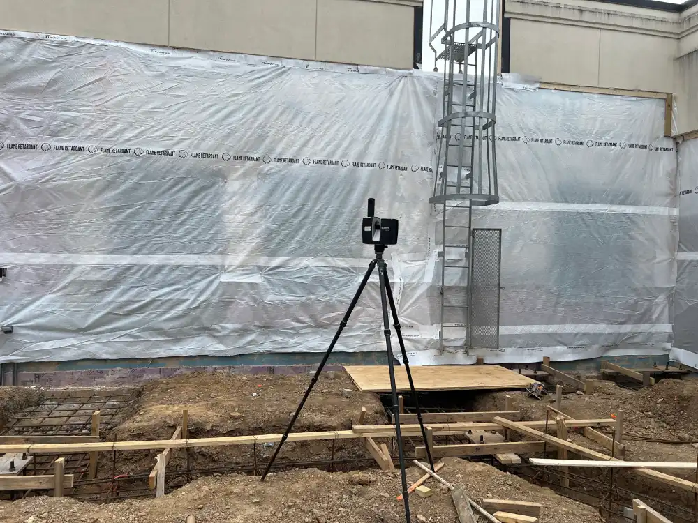
In modern commercial construction and renovation, traditional measuring tools—tape measures, plumb bobs, and static 2D blueprints—are no longer enough to manage complex jobsites. Spatial discrepancies, undocumented field alterations, and unexpected utility clashes directly result in expensive change orders and blown project timelines.
Integrating high-definition 3D laser scanning services provides millimeter-accurate reality capture that eliminates guesswork before work begins.
Below is an actionable guide explaining how 3D laser scanning works, how it actively protects project margins and saves money, and the exact steps to hire Orange Grove Partners (OGP) for your next build.
1. What Is 3D Laser Scanning and How Does It Work?
3D laser scanning (also known as LiDAR or High-Definition Surveying/HDS) is a non-destructive reality capture method that measures the physical dimensions of spaces, structures, and systems using laser light.
The technical workflow involves three core phases:
Phase 1: Rapid Field Capture
A certified technician deploys a terrestrial laser scanner across designated scan locations on the site. The scanner emits hundreds of thousands of invisible, eye-safe laser pulses per second, measuring the precise distance and angle of every surface it touches—including structural steel, MEP conduit, concrete floor slabs, and wall angles.
Phase 2: Point Cloud Registration
The raw spatial data captured from individual scan stations is digitally stitched together using advanced registration software. The output is a unified point cloud—a millimeter-accurate, 3D digital duplicate of the existing environment.
Phase 3: Deliverable Conversion (Scan-to-BIM & CAD)
Through OGP’s 3D modeling services, the dense point cloud is converted into workable Revit models, Navisworks clash models, 2D CAD floor plans, or floor flatness heatmaps depending on project requirements.
2. How 3D Laser Scanning Saves Money and Protects Your Bottom Line
Contractors often view 3D laser scanning as an upfront line-item expense; in practice, it functions as an insurance policy that delivers immediate return on investment (ROI).
A. Eliminates Unplanned Trade Clashes
In commercial and healthcare renovations, mechanical, electrical, and plumbing (MEP) trades often fabricate piping and ductwork based on outdated as-built drawings. When field conditions differ by even two inches, prefabricated materials cannot be installed. Laser scanning reveals true structural dimensions so coordination teams can resolve clashes virtually in Revit or Navisworks rather than cutting steel on the jobsite.
B. Prevents Destructive Concrete Remediation
During pre-pour inspections, laser scanning ensures plumbing stub-ups, electrical conduits, and anchor bolts match design specifications before the concrete trucks arrive. Correcting misplaced pipe penetrations after a slab cures requires slab cutting, X-ray scanning, and structural core drilling—frequently saving contractors upwards of $40,000+ in rework costs on a single pour.
C. Maximizes Off-Site Prefabrication
Prefabricating modular components and MEP skids saves labor hours only if the site measurements are exact. Laser scanning provides verified spatial data, enabling fabricators to build off-site with confidence that materials will fit on the first attempt.
D. Eliminates Return Site Visits for Measuring
Manual surveys miss overhead elevations, conduit runs, and ceiling cavity depths. A comprehensive laser scan captures the entire spatial envelope at once, giving project managers, architects, and engineers full virtual access to the jobsite from their computers.
Financial Impact: Traditional Surveying vs. 3D Laser Scanning
| Project Phase | Traditional Methods | 3D Laser Scanning (OGP) |
|---|---|---|
| As-Built Documentation | Days/weeks of manual tape measuring with missing blind spots. | Full spatial capture completed in hours with millimeter precision. |
| MEP Coordination | Clashes discovered live during installation, causing trade stop-work. | Clashes resolved digitally in Navisworks/Revit before fabrication. |
| Rework & Change Orders | Industry average 5%–12% of total project cost spent on rework. | Rework reduced by up to 80%, directly protecting contractor margins. |
| Travel & Site Visits | Repeated field visits to re-measure missed overhead elements. | Complete digital twin accessible remotely by all project stakeholders. |
3. How to Hire Orange Grove Partners (OGP)
Mobilizing OGP for your project is designed to be streamlined for fast-moving pre-construction and field schedules:
- Submit Project Scope: Contact us via our online request form or call (561) 225-4220. Share project location, square footage, site access dates, and desired deliverables (raw point cloud, 2D CAD as-builts, or LOD 300 Revit BIM models).
- Scoping & Proposal: Our technical team reviews project specifications, access logistics, and timelines to deliver a targeted, transparent proposal within 24–48 hours.
- Field Scanning Mobilization: Certified reality capture technicians deploy to your jobsite with precision laser scanners and drone equipment, capturing data without disrupting active field operations.
- Data Delivery & Integration: You receive registered point clouds, deviation reports, and coordinated 3D models ready for immediate import into Revit, AutoCAD, or Navisworks.
Contact Our Construction Technology & Reality Capture Team
At Orange Grove Partners (OGP), helping modern engineering and construction companies integrate cutting-edge technology into their field workflows is our top priority.
As a trusted, specialized construction technology firm with over 100 years of combined network experience, our experts specialize in deploying high-definition 3D laser scanning, drone aerial mapping, 3D modeling & BIM services, VDC execution planning, constructability reviews, and specialized project management supplemental staffing. We bridge the gap between physical jobsites and digital workflows—ensuring millimeter-accurate reality capture, zeroed-out field clashes, and seamless technology adoption for field crews.
We proudly serve general contractors, MEP engineers, design-builders, and commercial project owners across key regional hubs, including Florida (Miami, Fort Lauderdale, West Palm Beach, Tampa, Orlando) and Tennessee (Nashville, Memphis, Knoxville). Whether you need pre-construction reality capture, on-site tech implementation, or fractional VDC management, give us a call today at (561) 225-4220 or get in touch online for expert construction tech solutions you can rely on.
Hire Our Services In
- Florida: Miami-Dade, Broward, Palm Beach, Orange, Hillsborough Counties
- Tennessee: Davidson, Shelby, Knox Counties
Hours
- Monday – Friday: 7:00 AM – 6:00 PM EST
- Saturday: By Appointment
- Sunday: Closed
(On-site emergency scanning & weekend capture scheduling available upon request)