
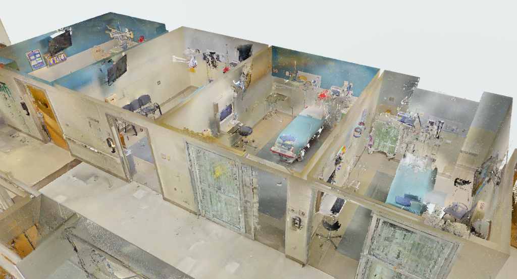
In an era where precision and efficiency define success, relying on outdated 2D plans or manual site walks is a massive competitive disadvantage. 3D mapping technology is revolutionizing industries by helping businesses turn complex physical spaces into accurate, interactive digital models. This spatial intelligence allows teams to engage in safer planning, achieve faster navigation, and collaborate remotely with absolute clarity.
From preventing costly reworks on active construction sites to keeping emergency responders out of harm’s way, the ability to digitally replicate the real world is transforming operations from the ground up. Let’s explore the top commercial use cases driving this technological shift.
Top Business Use Cases for 3D Mapping Technology
The applications for high-definition spatial data stretch far beyond basic surveying. Here is how modern businesses are leveraging reality capture to build smarter and operate safer.
Construction and Infrastructure Monitoring
For developers and general contractors, staying on schedule means catching errors before they happen. By combining drone footage with platforms like Autodesk Construction Cloud, project teams can:
- Track work progress efficiently without deploying massive manual survey crews.
- Measure volumes of earthwork, cut-and-fill, and stockpiles with high precision.
- Compare active building sites directly against original architectural blueprints to spot deviations instantly.
Warehousing and Logistics
The modern supply chain moves incredibly fast, and facility managers need a constant pulse on their floor operations. Using spatial platforms like the Niantic Spatial Platform, logistics companies can:
- Track inventory accurately across massive facility footprints.
- Guide warehouse workers using augmented reality (AR) overlays to locate and pick items faster.
- Monitor floor operations remotely, identifying workflow bottlenecks without needing to be physically on-site.
Urban Planning and GIS
Building the cities of tomorrow requires understanding exactly how new infrastructure will impact the existing environment. City planners rely on robust geographic information systems (GIS) like Esri ArcGIS to:
- Model city growth and visualize urban sprawl before breaking ground.
- Simulate flood risks to design resilient drainage and emergency systems.
- Plan public infrastructure that accurately fits the natural topography and serves the community effectively.
Autonomous Navigation and Delivery
The future of transportation requires more than standard flat-map GPS. Self-driving cars and delivery drones operate in highly dynamic, unpredictable environments. To avoid obstacles and navigate complex cityscapes safely, these automated systems rely heavily on real-time 3D landscape data to accurately “see” and interpret the physical world around them.
Disaster Response and Site Inspection
When a crisis strikes, speed and safety are paramount. 3D mapping allows emergency response teams and commercial roof inspectors to map hazardous or incredibly large areas rapidly. Whether assessing severe structural storm damage or tracking the spread of wildfires, this technology provides critical intelligence from a completely safe distance.
Ready to Digitize Your World?
The benefits of adopting 3D spatial data are undeniable—reduced risk, accelerated timelines, and absolute project clarity. If you are ready to stop guessing and start measuring with millimeter accuracy, it is time to bring reality capture to your next project.
Contact Our Construction Technology & Reality Capture Team
At Orange Grove Partners (OGP), helping modern engineering and construction companies integrate cutting-edge technology into their field workflows is our top priority.
As a trusted, specialized construction technology firm with over 100 years of combined network experience, our experts specialize in deploying high-definition 3D laser scanning, drone aerial mapping, 3D modeling & BIM services, VDC execution planning, constructability reviews, and specialized project management supplemental staffing. We bridge the gap between physical job sites and digital workflows—ensuring millimeter-accurate reality capture, zeroed-out field clashes, and seamless technology adoption for field crews.
We proudly serve general contractors, MEP engineers, design-builders, and commercial project owners across key regional hubs, including Florida (Miami, Fort Lauderdale, West Palm Beach, Tampa, Orlando) and Tennessee (Nashville, Memphis, Knoxville). Whether you need pre-construction reality capture, on-site tech implementation, or fractional VDC management, give us a call today at (561) 225-4220 or get in touch online for expert construction tech solutions you can rely on.
Hire Our Services In
- Florida: Miami-Dade, Broward, Palm Beach, Orange, Hillsborough Counties
- Tennessee: Davidson, Shelby, Knox Counties
Hours
- Monday – Friday: 7:00 AM – 6:00 PM EST
- Saturday: By Appointment
- Sunday: Closed
(On-site emergency scanning & weekend capture scheduling available upon request)